Section 4 ITS toward Standard Deployment

Measures against Natural Disasters


-Kagoshima Prefecture: Early detection of disasters on roads
In Tarumi City, Kagoshima Prefecture, accumulated volcanic ash from Mt. Sakurajima collapsed into an avalanche of sand and stones due to the erosion caused by heavy rainfall during the rainy season or from typhoons. This inflicted serious damage on the city. The Kyushu Regional Construction Bureau has installed eight road monitoring cameras and night-time lighting equipment on the traffic control section of National Route 220, which runs through Tarumi City. This monitoring system constantly transmits image signals through optical fiber cables in order to detect signs of an avalanche at an early stage and put disaster prevention into effect promptly.


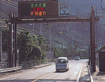
Real-time information is displayed on the road information panel.

A operations center full of road management systems, including a monitoring system. Collected information is provided from the center.


-Hokkaido: Automatic detection of a high surf crossing a road through image processing
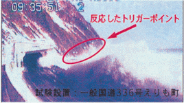
On roads along the seashore, traffic may be hindered by surf splashing over roads and rocks falling from waves. The Civil Engineering Institute of the Hokkaido Development Bureau has developed a monitoring system to detect a high surf automatically from images transmitted from cameras installed on roads. The system also transmits still pictures to road management agencies, and records them as video. It has a mechanism under which signals are transmitted when input images of a target trigger point change, and a high surf is detected through image processing. At present, the system is in test operation on National Route 336, where a high surf often splashes over the routes.


An automatically-transmitted still picture of a surf crossing the road


-Tohoku District: On-site image transmission system
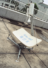
KU-SAT, a satellite-based system for transmitting visual information from the scene of a disaster, is used to support rehabilitation activities, including the dispatch of emergency vehicles. It is a handy portable system for satellite communication, making it especially suited for use in tight areas or mountainous regions where microwave circuits are not available.

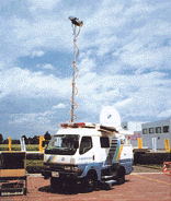
During the heavy rain in August 1995, the Tohoku Regional Construction Bureau used KU-SAT in the disaster-stricken area to establish links with the disaster response headquarters and construction offices.The system served to facilitate site inspections and study of measures by the headquarters staff, dispatch emergency vehicles efficiently and reopen promptly the roads that had been closed by the disaster. Also available at the bureau are special 4WD disaster vehicles equipped with the KU-SAT system.


KU-SAT can be used without a radio operator.

This small-sized and lightweight system can respond to an emergency quickly.

4-wheel drive disaster vehicles equipped with the KU-SAT system


Go to ITS HandBook


Back to Home