
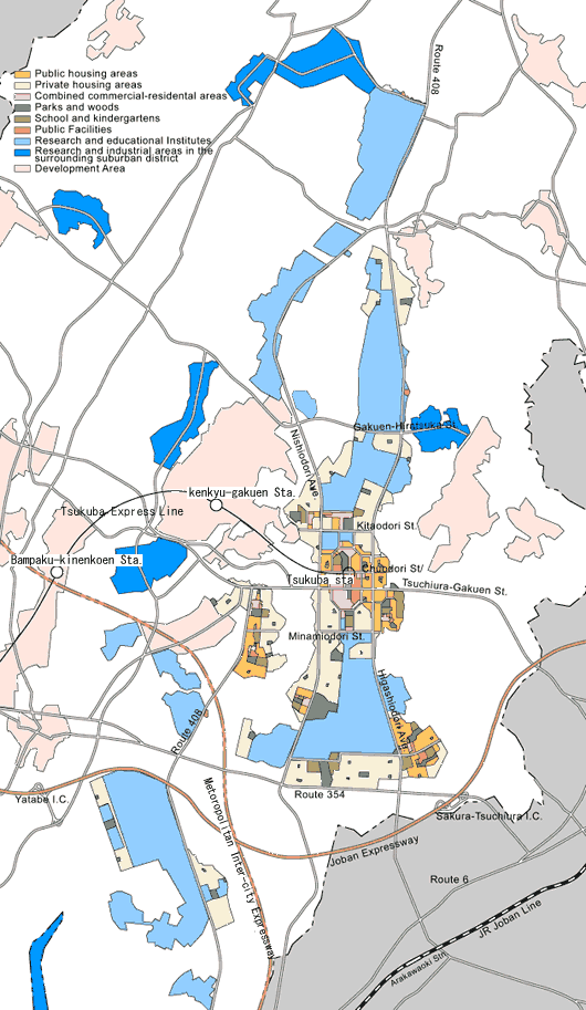
Master Plan

in order to avoid impeding local people's daily lives and farm management as much as possible. For this reason, the city's Master Plan was targeted on long thin development area running from north to south from the beginning.
In its first blueprint(see the map to the right), the new city has two main arterial roads running through it from north to south like a backbone; in the middle of those is the main city area, and at the center of this is the heart of the city, where urban institutions are concentrated. As one travels east from this center, another arterial road leads to the Tsuchiura city center. With the university area in the north, and the research facilities in the south, the two arterial roads serve as an arena to bring those separate areas of activity together.
This blueprint, the first complete image of Tsukuba Science City, played a very large role later. The first Master Plan was created in July 1965. Since then, details of the plan had been refined many times, taking opinions from research and educational institutions and a trend of land procurement negotiations into account. The forth master plan which forms the backbone of the present project was drawn in 1969. The present city plan is based on that, but with further modifications to match the existing reality.
[See the complete plan diagram]
 | The Science City Planning Area | |
| Urbanization Area | ||
| City Center District | ||
| District for Research and Educational Institutions | ||
| Parks and Greenway | ||
| Planned Housing District | ||
| Private Housing Area | ||
| Suburban Private Housing Area | ||
| Industrial and Service Industry District |
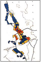
| The First Plan (Jul.1965) 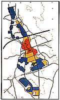 | The
Second Plan (Feb.1966) 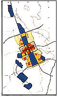 | The
Third Plan (Apr. 1967) 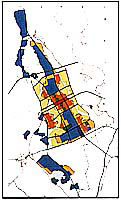 |