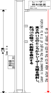
Image diagram of laser. Range of irradiation: 80 m
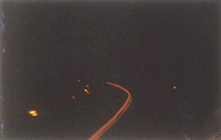
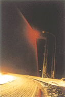
Test operations got underway on National Route 7 in Aomori City.
The position of the outer edge of the road is shown in red by laser.
| Section 4 ITS toward Standard Deployment |
Measures against snowfall |
The Tohoku Regional Construction Bureau has developed a system to use lasers on the roads and indicate the outer edge of the road with red laser light. The system enables drivers to know the outer edge accurately. After experiments were conducted in January 1996, the system was installed on National Route 7 in Aomori City in January 1997 to launch test operations and observe effects of the system.
|
Image diagram of laser. Range of irradiation: 80 m |
Test operations got underway on National Route 7 in Aomori City. The position of the outer edge of the road is shown in red by laser. |
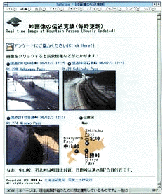
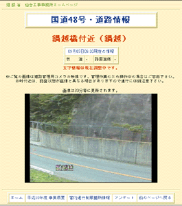
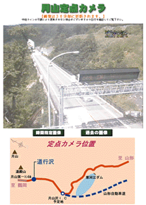
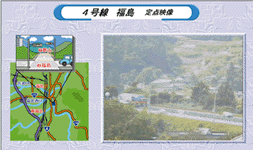
The Civil Engineering Research Institute, Hokkaido Development Bureau, provided information under an "experiment to transmit images of mountain passes" from November 1997 to May 1998. The up-to-the-hour images of Nakayama Pass on National Route 230, Ishikita Pass on Route 39 and Hikachi Pass on National Route 274 together with information on weather, temperature, road surface conditions and traffic control were provided via internet. The images and information were updated every hour automatically.
 |
 |
 |
 |


