The Japan Meteorological Agency (JMA) observes earthquakes with a nation-wide
observation network and issues information on earthquakes and forecast on tsunami
warnings and advisories on a 24 hour basis. The Meteorological Service Low prescribes
that the Director-General of JMA shall immediately submit to the Prime Minister
the "earthquake prediction information", when he apprehends that the Tokai Earthquake
is impending, which is subject to disaster prevention measures. As a means to
making a precise decision by the Director-General of the Meteorological Agency,
the "Earthquake Phenomena Observation System (EPOS)", which processes and monitors
various earthquake-related observation data on a real time basis, is in operation
(Picture. 7).
As it was impossible to measure the seismic intensity of 7 with the seismic
intensity meter quickly in accordance with the present seismic intensity scale
and the definition of the seismic intensity scale became outdated, JMA established
a committee for examination of seismic intensity issues on March 16, 1995 and
made an interim report on July 5. The report indicated that all degrees of seismic
intensity, including the 7th degree should be measured and announced promptly,
because various disaster prevention organizations use the seismic intensity
information for the system of initiation of their actions and the promptness
of the provision of the information would be a great significance for the prevention
of earthquake disasters.
In accordance with this policy, funded from the first and second supplementary
budget in the fiscal year 1995. JMA replaced all of its seismic intensity meters
with new ones which can measure the 7th degree and installed the new model at
574 places, the number increased from 290 places in the past. Thus JMA has established
a network for observation of seismic intensity covering all populated areas
in Japan with the mesh size of 20 km.
In addition, in order to secure the transmission of data of the seismic
intensity, the earthquake resistance of the earthquake observation facilities
against earthquake will be improved and in order to avoid any interruption of
transmission of data on the seismic intensity due to the damage on ground telecommunication
cables, the information transmission system will be made duplicated utilizing
Geostationary Meteorological Satellite.
As part of research activities for the development of technology for prediction
of earthquake at an active fault, the facilities for observation of earth current
are planned to be built in the northern region of Awaji Island.
(2) Promotion of disaster prevention measures taking earthquake information
into account
The Law on Special Measures for Prevention of Earthquake Disaster was established
on 1995, which prescribes the establishment of a 5-year plan of urgent works
for the prevention of the earthquake disaster, special financial measures for
those works, improvement of the survey and research system on earthquake, etc.
Based on this law, the Director-General of JMA, on the request of the Chief
of the Office for Promotion of Earthquake Survey and Research (the Director-General
of the Science and Technology Agency), shall collect the information on earthquake
from universities and other authorities at the Headquarters of JMA and District
Meteorological Observatories, which are regarded as district earthquake information
centers, and shall report the collected data to the Office for Promotion of
Earthquake Survey and Research. Furthermore, based on the law and funded by
the second supplementary budget in the fiscal year 1995, a system was established
which enables JMA to collect and monitor the data on the earthquake and the
earth crust in Japan obtained by related government authorities and universities,
etc. The monitoring aims at promoting the study on earthquake prediction.
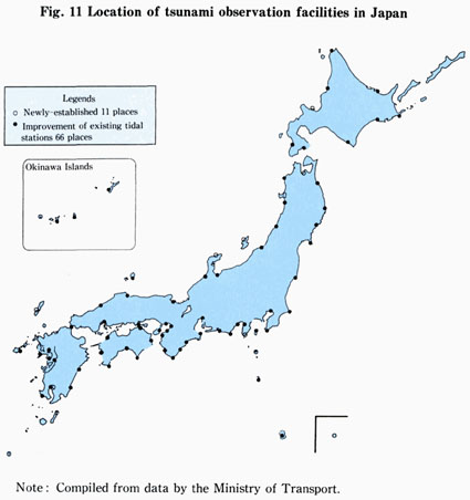
JMA has divided the coast of Japan into 18 blocks for the tsunami forecast and six regional centers issue tsunami forecasts for their responsible areas and announce them promptly. While tsunamis are regularly monitored at 66 automatic tide-gauge stations, eleven tsunami observation facilities will be newly established and the observation system of the large-scale tsunami will be improved or installed at 76 observation points including existing automatic tide-gauge stations in order to strengthen the system, founded from the first and second supplementary budgets in the fiscal year 1995, (Fig. 11). Furthermore, JMA has plans to establish a more prompt and detailed tsunami forecasting system, utilizing a satellite-based network for early detection of tsunami and earthquake and for simultaneous transmission of emergency information.
As the change of situation of crust at the bottom of sea gives precursors
of earthquake, the Maritime Safety Agency is conducting surveys on the situation
of the bottom of sea through monitoring and observation of the change of the
submarine crust utilizing surveys on submarine topography and geological structure,
observation on tides, geomagnetic observation, gravity observation, etc. to
collect and analyze basic data for prediction of earthquake.
Based on the experience from the earthquake this time, the survey on the
submarine topographical change was conducted at the Akashi Strait and Osaka
Bay and 8 dislocations have been confirmed. In fiscal 1995, it is planned to
conduct surveys on active dislocations at Tokyo, Osaka and Ise Bays and, for
the purpose of strengthening the earth-quake prediction system in the Kansai
District, monitoring and observation of submarine crust changes.