Weather Status
View info on weather conditions such as typhoons, along with rainfall, river levels and more from the MLIT, etc.
-
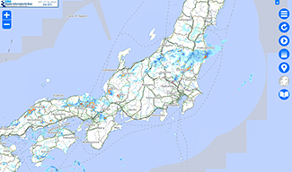
Disaster Information for Rivers
MLIT | Can confirm weather, river, landslide, and other information on one screen. The information includes XRAIN (radar precipitation), weather warnings and advisories, river CCTV camera views, river level data, rivers with rising inundation risks, and flooding forecast.
- Earthquake and Tsunami Disaster

- Wind and Flood Disaster
- Volcanic Disaster
- Snow Disaster
- Other
- 日本語
- English
- 한국어
- 中文(簡体)
- 中文(繁体)
- ประเทศไทย
- Tiếng Việt
- Português
- Hokkaido
- Tohoku
- Kanto
- Hokuriku
- Chubu
- Kinki
- Chugoku
- Shikoku
- Kyushu
- Earthquake and Tsunami Disaster
-
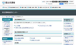
Center for Providing Disaster Management Information
MLIT | Consolidates MLIT’s disaster prevention information and provides it in an easy-to-understand manner
- Earthquake and Tsunami Disaster
- Wind and Flood Disaster
- Volcanic Disaster
- Snow Disaster
- Other
- 日本語
- English
- 한국어
- 中文(簡体)
- 中文(繁体)
- ประเทศไทย
- Tiếng Việt
- Português
- Hokkaido
- Tohoku
- Kanto
- Hokuriku
- Chubu
- Kinki
- Chugoku
- Shikoku
- Kyushu
- Earthquake and Tsunami Disaster
-
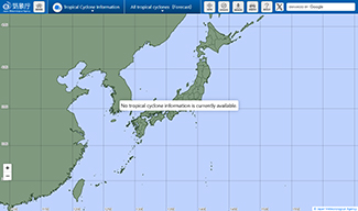
Typhoon Information
Japan Meteorological Agency | Latest typhoon information released by JMA
- Earthquake and Tsunami Disaster
- Wind and Flood Disaster
- Volcanic Disaster
- Snow Disaster
- Other
- 日本語
- English
- 한국어
- 中文(簡体)
- 中文(繁体)
- ประเทศไทย
- Tiếng Việt
- Português
- Hokkaido
- Tohoku
- Kanto
- Hokuriku
- Chubu
- Kinki
- Chugoku
- Shikoku
- Kyushu
- Earthquake and Tsunami Disaster
-
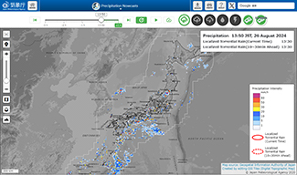
Precipitation Nowcasts
Japan Meteorological Agency | Displays rainfall status and rainfall forecasts on a map based on radar observations
- Earthquake and Tsunami Disaster
- Wind and Flood Disaster
- Volcanic Disaster
- Snow Disaster
- Other
- 日本語
- English
- 한국어
- 中文(簡体)
- 中文(繁体)
- ประเทศไทย
- Tiếng Việt
- Português
- Hokkaido
- Tohoku
- Kanto
- Hokuriku
- Chubu
- Kinki
- Chugoku
- Shikoku
- Kyushu
- Earthquake and Tsunami Disaster
-
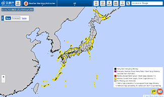
Weather Warnings & Advisories
Japan Meteorological Agency | Latest weather warnings and advisories released by JMA
- Earthquake and Tsunami Disaster
- Wind and Flood Disaster
- Volcanic Disaster
- Snow Disaster
- Other
- 日本語
- English
- 한국어
- 中文(簡体)
- 中文(繁体)
- ประเทศไทย
- Tiếng Việt
- Português
- Hokkaido
- Tohoku
- Kanto
- Hokuriku
- Chubu
- Kinki
- Chugoku
- Shikoku
- Kyushu
- Earthquake and Tsunami Disaster
-
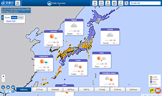
Weather Forecast
Japan Meteorological Agency | Latest weather forecast released by JMA
- Earthquake and Tsunami Disaster
- Wind and Flood Disaster
- Volcanic Disaster
- Snow Disaster
- Other
- 日本語
- English
- 한국어
- 中文(簡体)
- 中文(繁体)
- ประเทศไทย
- Tiếng Việt
- Português
- Hokkaido
- Tohoku
- Kanto
- Hokuriku
- Chubu
- Kinki
- Chugoku
- Shikoku
- Kyushu
- Earthquake and Tsunami Disaster
-
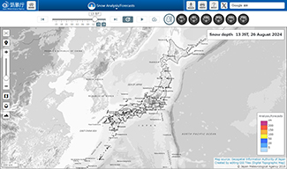
Snow Analysis/Forecasts
Japan Meteorological Agency | Snow depth, snowfall amount distribution, and forecast information published by the Japan Meteorological Agency
- Earthquake and Tsunami Disaster
- Wind and Flood Disaster
- Volcanic Disaster
- Snow Disaster
- Other
- 日本語
- English
- 한국어
- 中文(簡体)
- 中文(繁体)
- ประเทศไทย
- Tiếng Việt
- Português
- Hokkaido
- Tohoku
- Kanto
- Hokuriku
- Chubu
- Kinki
- Chugoku
- Shikoku
- Kyushu
- Earthquake and Tsunami Disaster
-
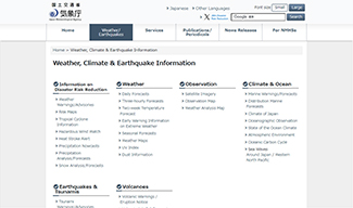
Weather, Climate & Earthquake Information
Japan Meteorological Agency | Aggregates JMA’s weather forecasts and disaster prevention information
- Earthquake and Tsunami Disaster
- Wind and Flood Disaster
- Volcanic Disaster
- Snow Disaster
- Other
- 日本語
- English
- 한국어
- 中文(簡体)
- 中文(繁体)
- ประเทศไทย
- Tiếng Việt
- Português
- Hokkaido
- Tohoku
- Kanto
- Hokuriku
- Chubu
- Kinki
- Chugoku
- Shikoku
- Kyushu
- Earthquake and Tsunami Disaster
-
Weather (Weather, Heavy Rain, High Temperature, etc.), Earthquake, Tsunami, Volcano Information
Japan Meteorological Agency | Provides information on weather, earthquakes, tsunamis, and volcanoes in multiple languages
- Earthquake and Tsunami Disaster
- Wind and Flood Disaster
- Volcanic Disaster
- Snow Disaster
- Other
- 日本語
- English
- 한국어
- 中文(簡体)
- 中文(繁体)
- ประเทศไทย
- Tiếng Việt
- Português
- Hokkaido
- Tohoku
- Kanto
- Hokuriku
- Chubu
- Kinki
- Chugoku
- Shikoku
- Kyushu
- Earthquake and Tsunami Disaster
-
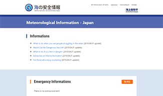
Maritime Information and Communication System
Japan Coast Guard | Provides localized weather and hydrographic data, including wind direction, wind speed, and wave height observed at lighthouses and other sites across Japan
- Earthquake and Tsunami Disaster
- Wind and Flood Disaster
- Volcanic Disaster
- Snow Disaster
- Other
- 日本語
- English
- 한국어
- 中文(簡体)
- 中文(繁体)
- ประเทศไทย
- Tiếng Việt
- Português
- Hokkaido
- Tohoku
- Kanto
- Hokuriku
- Chubu
- Kinki
- Chugoku
- Shikoku
- Kyushu
- Earthquake and Tsunami Disaster
-
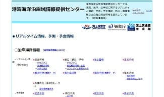
The Ports, Harbor and Coastal Ocean Information Center
Ports and Harbours Bureau, Japan Meteorological Agency, Japan Coast Guard | Provides comprehensive ocean information, including real-time information on harbors, oceans, and coastal areas, forecasts and plans, and information on disaster prevention and the environment
- Earthquake and Tsunami Disaster
- Wind and Flood Disaster
- Volcanic Disaster
- Snow Disaster
- Other
- 日本語
- English
- 한국어
- 中文(簡体)
- 中文(繁体)
- ประเทศไทย
- Tiếng Việt
- Português
- Hokkaido
- Tohoku
- Kanto
- Hokuriku
- Chubu
- Kinki
- Chugoku
- Shikoku
- Kyushu
- Earthquake and Tsunami Disaster
-
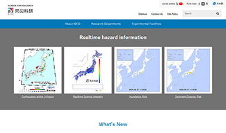
National Research Institute for Earth Science and Disaster Resilience
(National Research and Development Agency) National Research Institute for Earth Science and Disaster Resilience | Provides access to real-time earthquake and weather information, public data, and content for learning about disasters
- Earthquake and Tsunami Disaster
- Wind and Flood Disaster
- Volcanic Disaster
- Snow Disaster
- Other
- 日本語
- English
- 한국어
- 中文(簡体)
- 中文(繁体)
- ประเทศไทย
- Tiếng Việt
- Português
- Hokkaido
- Tohoku
- Kanto
- Hokuriku
- Chubu
- Kinki
- Chugoku
- Shikoku
- Kyushu
- Earthquake and Tsunami Disaster