The Road GIS, which can efficiently collect, control, and provide various information, such as traffic regulations due to construction works and damage, is a common software platform for various applications, such as car navigation and route guidance for pedestrians, and is expected to be deployed in advanced services of the private sector. Therefore, the constructed Road GIS data will be made available to the private sector to assist their business and create new industries that utilize map information.
Predicted scales of GIS-related markets
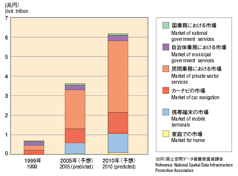
Image of Road GIS deployment
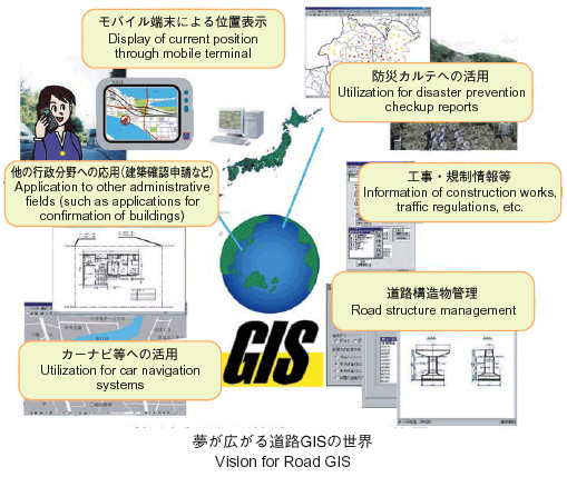
 Expected deployment for the advanced private-sector services

