 Deployment of Road GIS for disaster prevention
Deployment of Road GIS for disaster prevention
Deployment of Road GIS for disaster prevention
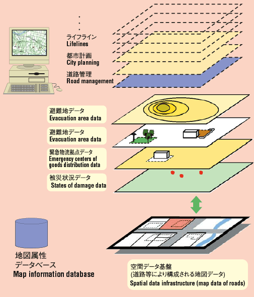
Information systems, such as GISUtilization of GIS
 Occurrence of an earthquake
 Collecting and transmitting disaster information
 Drawing up urgent restoration plans (with the support of various data)
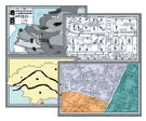
 Links with various data
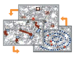 Selecting the emergency transportation routes (based on information on the affected areas and the locations of disaster-prevention centers)
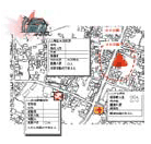
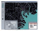
 Organizing and preparing maps of damage information (real-time display of the disaster are on a map)
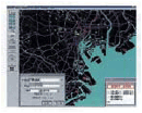 Predicting damage (prediction of affected areas and scale of damage using seismic information)
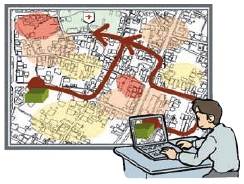
 Establishing the initial action system (quick determination of establishing initial systems based on the predicted damage)
 |

