Like a car navigation system, the ITS for Pedestrians consists of a positioning system and digital maps, but of much higher precision than those for vehicles. Technologies are also needed to track positions even underground and indoors without any gap.
The following four positioning methods are being investigated:
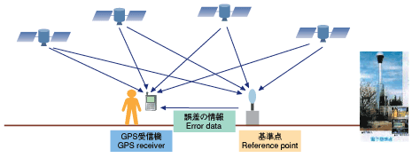
D-GPS
The D-GPS method separately measures the errors in GPS positioning, and improves the precision by transmitting the error data to the mobile communication station.
D-GPS
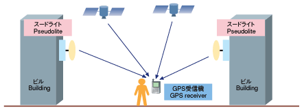
Pseudolite (Pseudo GPS)
A pseudo GPS satellite (pseudolite) is installed on the ground, which sends the same waves as those from a GPS satellite to enable positioning in locations where it is difficult to receive the waves from GPS satellites, such as between tall buildings, underground, and indoors.
Pseudolite (pseudo GPS)
Wireless LAN
The waves of 2.4 GHz frequency, which are used for wireless LAN, can be used as the waves from Pseudolite in the same way to determine position.
Wireless LAN
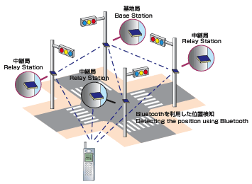
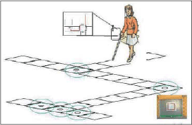
RF-ID tags
The RF-ID tag method installs RF-ID tags (passive type) equipped with IC chips, which are widely used for physical distribution, on the ground surface along sidewalks, and the location is identified by a portable terminal which detects the tag number.
RF-ID tag
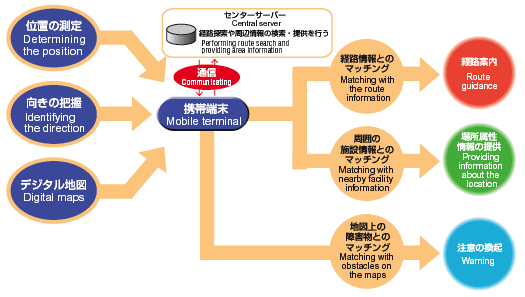
 System constitution of ITS for Pedestrians

