- |
- Top
- |
- Points
- |
- Non-Structural Measures
- |
- Structural Measures
- |
- Communities
- |
- Japanese
- |

The relevant organizations will focus on non-structural measures from the perspective of residents, especially in high-flood-risk areas, whereby residents can be alerted to danger and evacuate spontaneously, using measures such as an active information service through smartphones.
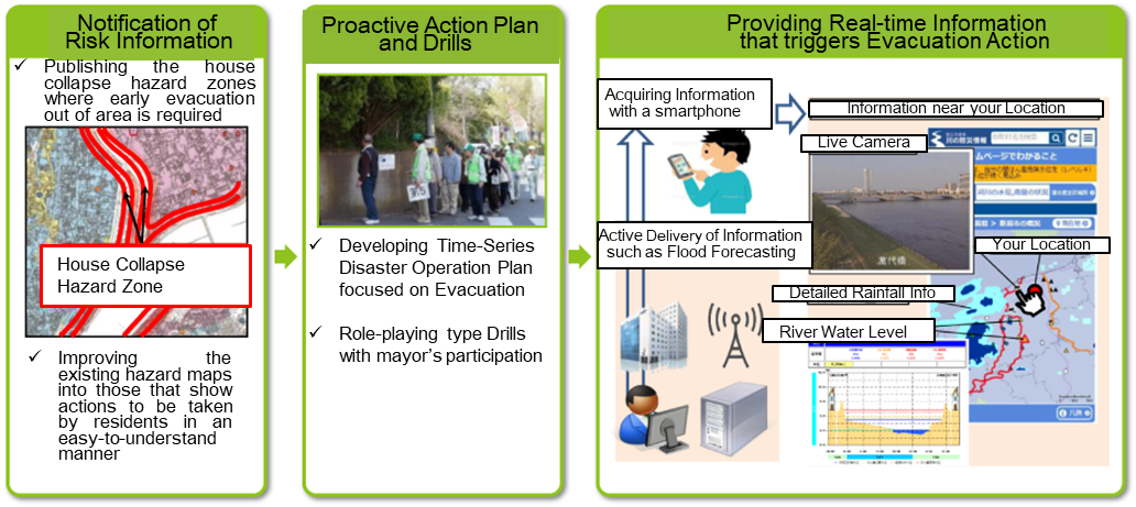
Dissemination of risk information which triggers action by residents

|
|||||
|
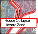
For residents to take appropriate actions, the relevant organizations will publicize information
regarding locations where torrential outflow is likely to occur and affect houses.
|
Publicizing details on house collapse hazard zones where early evacuation is required : The MLIT has already published information for all 109 river systems. |
|||
|
|
|||||
|
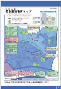
Relevant organizations will improve flood hazard maps to make them more effective
for residents by identifying areas in need of evacuation as soon as possible.
|
Innovation of hazard maps which can directly assist priority evacuation action: The guideline for flood hazard mappings was revised based on opinions provided by the Flood Hazard Map Review Committee including identifying zones where early evacuation are required. - Guideline of Flood Hazard Mappings - Portal site of the Hazard Maps - Flood Hazard Map Review Committee |
|||
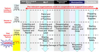
Developing a Time-series Disaster Operation Plan for Floods and Promoting Drills
|
|
|||||
|
The relevant organizations will create a Time-Series Disaster Operation Plan for Flooding, which details time-series information sharing and actions to be taken by each organization during disasters. It will be reviewed and amended following drills and actual flood responses.
|
All 730 municipalities with potential inundation zones caused by overflowing rivers managed by the MLIT had completed the creation of Time-Series Disaster Operation Plans for Flooding by June 2017. Flood response drills including role-play method are conducted with the mayor’s participation. |
|||
Providing real-time information that triggers evacuation
|
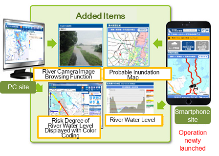
The MLIT will enhance real-time information dissemination via smart phones and PCs by providing flood information on neighbouring rivers during heavy rains.
|
Renewal of Disaster Information on Rivers in March 2016: The new functions include a current position display system using GPS and live images of nearby rivers through monitoring cameras. XRAIN GIS English (Mobile Phone only) The active flood information service started to provide the information of the 68 river systems managed by the MLIT by June 15, 2017. The flood forecasting service that cover all 109 river systems will be launched by 2020. |